Local disaster prevention at KDX Toyosu Grand Square
At KDX Toyosu Grand Square, we conduct disaster prevention measures tailored to the local area and are prepared for disasters.
Flood prevention plan
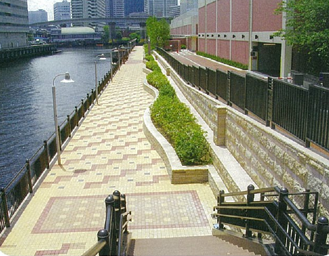
This area is protected by external seawalls from high tides and internal seawalls from torrential rains.
Image of internal seawall
Quoted from https://www.kouwan.metro.tokyo.lg.jp/jigyo/madoguchi/kensetsu-jimusyo/UmetateKankyo/
An internal seawall is a facility that prevents flooding in the hinterland due to the collapse of the bank during an earthquake, and also protects the hinterland from rising inland water levels due to the inflow of rain, sewage, etc. after the water gates and land barriers are closed during high tides. .
In terms of flooding, the first floor has been set to a level that will not flood even in the event of a once-in-100-year torrential rain event.
Public disaster prevention base
KDX Toyosu Grand Square is close to the Tokyo Rinkai Disaster Prevention Park, where the government will set up an emergency disaster response headquarters in the event of a major disaster in the Tokyo metropolitan area.
Please note that in the event of a large-scale disaster, it cannot be used as an evacuation site as it functions as a base camp for wide area support units and a support base for disaster medical care.
“Tokyo Rinkai Disaster Prevention Park” official website
https://www.tokyorinkai-koen.jp/news/5252/
Remaining area within the district
KDX Toyosu Grand Square is located in the remaining area of the district. Remaining areas within the district refer to areas where large urban fires do not occur, and even if a fire occurs, safety can be ensured by evacuating to an evacuation site near the water level, and there is no need to evacuate a wide area. The region to be specified.
disaster control center
In addition to installing surveillance cameras in common areas, staff are stationed at the disaster prevention center in case of unexpected trouble.
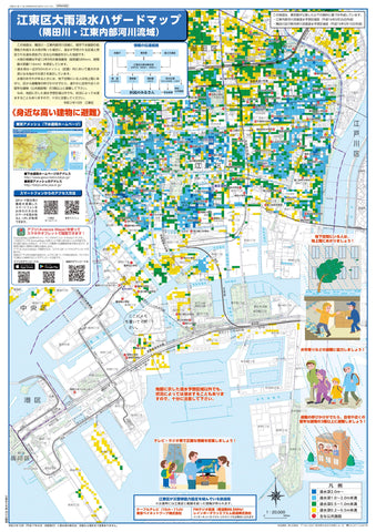
Heavy rain hazard map
Although this area is not expected to be flooded, please be careful as it may flood depending on the situation.
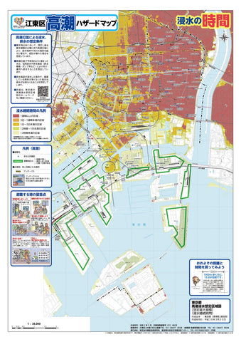
Storm surge hazard map
The expected depth of water in the event of flooding in this area is 0.5m to less than 3.0m. Evacuate to a place higher than the expected water depth.

Flood hazard map
This area is designated as an evacuation area in the event of a flood, but please be very careful when floods occur nearby.